Home

Geocaching


Cumberland Geocache

State Geocache is Located: Colorado

Latitude: 39 degrees 48.548 minutes North
Longitude: 105 degrees 37.802 minutes West
Elevation: 10,147 feet
Map Datum: WGS 84

GPS used to take readings: Garmin eTrex Venture

Date Geocache put in place: May 17, 2003

Distance to nearest paved road: 1/2 mile
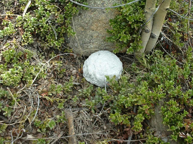
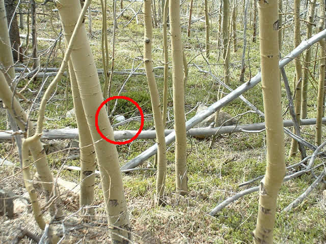
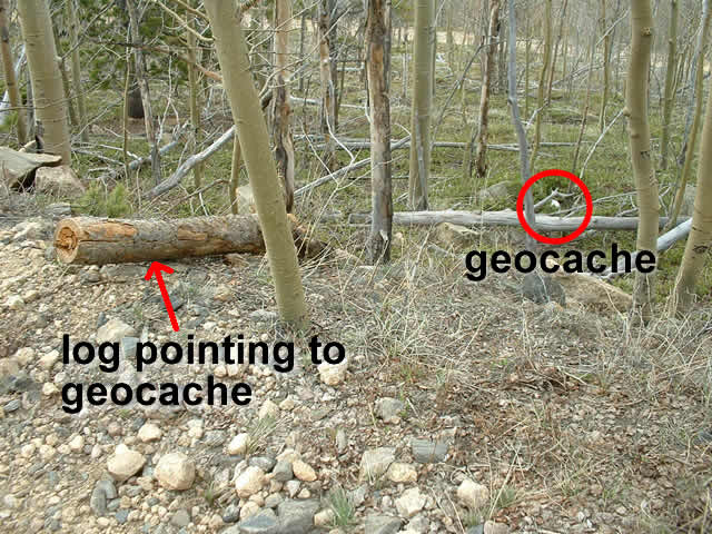
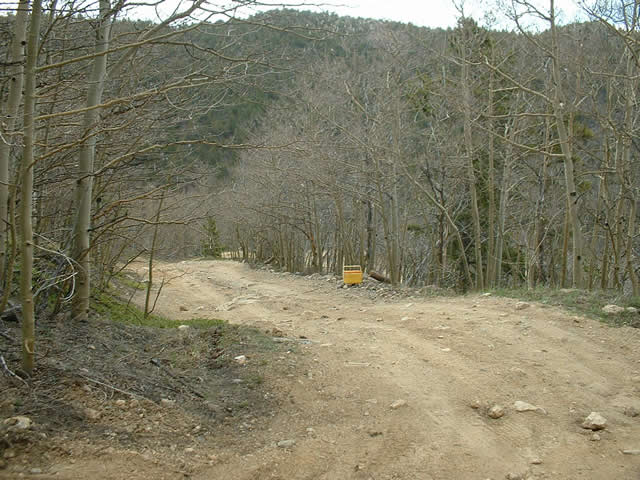
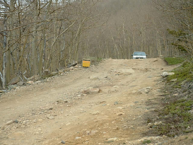
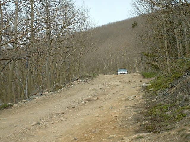
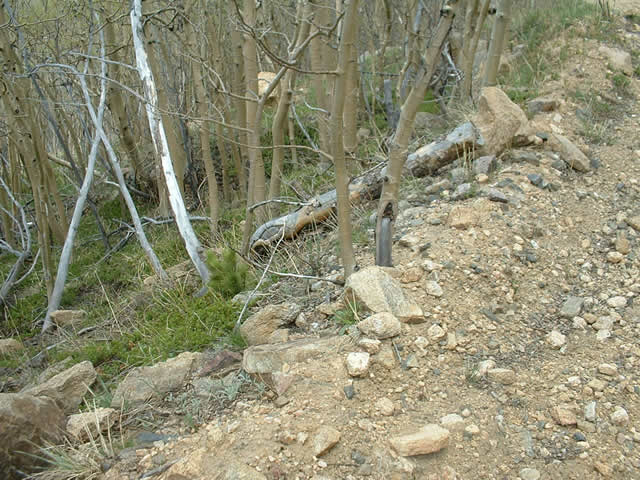
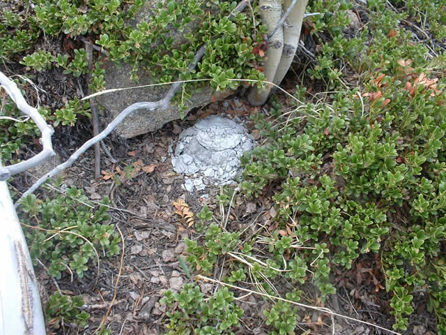
General comments about the Geocache Site: The geocache 
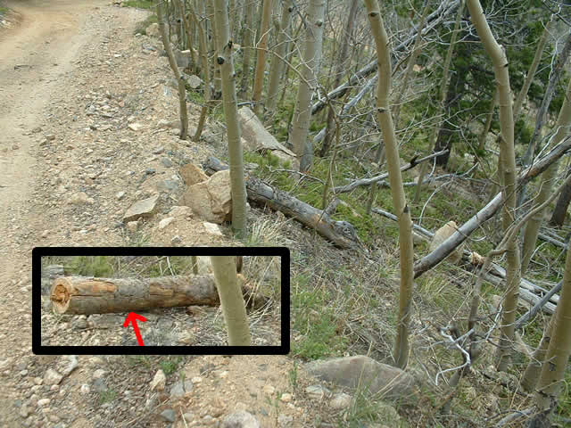
rock lies approximately 15 feet off of a 4-wheel drive trail. The trail is an easy trail to drive and can be driven with any stock SUV or offroad vehicle. The road pictured below is typical of the drive to the site. Due to the elevation and the type of road into the site, the geocache will be snowbound during the winter months. I placed the geocache in mid-May and the road just above the geocache was blocked by a snowdrift.
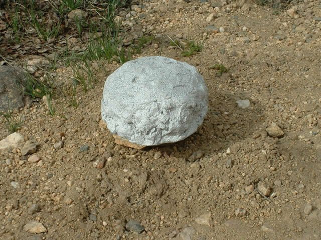
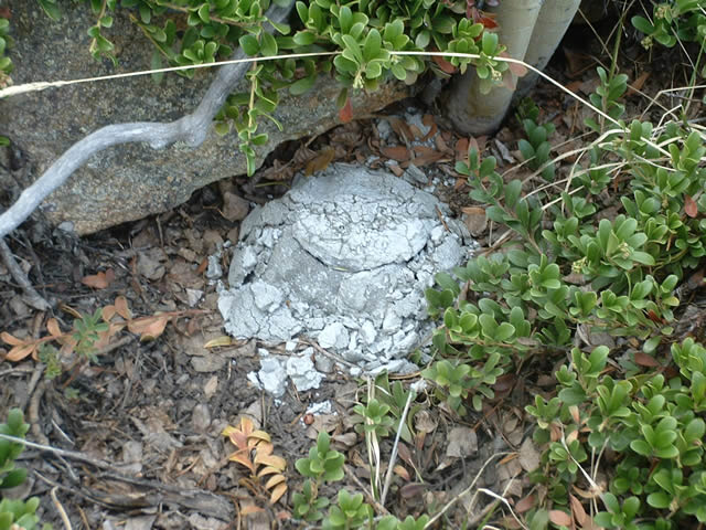
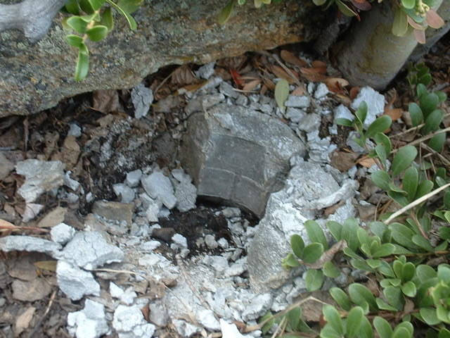
This geocache is the first one I built and the inside cavity is very small. As a result, there is no notepad inside to leave as a log. However, there is something inside. I will have this geocache as a virtual cache, meaning you need to email me and tell me what is inside. It may not be a virtual cache in the technical sense, but it is now. This is one reason I made this geocache a relatively easy one to find.

This is the geocache rock that was placed at this site.
Closeup view of geocache in it's resting place.
View of geocache from the road.
I have a log on the side of the road that points to the geocache. The geocache is approximately 15 - 20 feet down from the edge of the road.
This view is looking downhill. The cooler is next to the pointer log. Don't rely on the log always being there. Weather, melting snow, campers, hungry critters, etc. may move the log. And the cooler, of course, definitely won't be there. You may want to print out a copy of the larger picture to use as a reference to help you in pinpointing this spot.
This view is looking uphill. Again, the cooler is next to the pointer log.
Same view as above without the cooler.

Update: May 21, 2006
3 years later

With spring in full force, I was getting cabin crazy, so took a trip to the hills for some relaxation. I went by this cache to see how it was doing, and discovered that it had crumbled over the past 3 years. I've been by this geocache several times over the past 3 years, and all seemed ok. But this time, there was definite failing in the geocache, so I decided I better document it and post it.

The diagonal "pointer log" is still there- amazingly enough. Compare with the pic above, and you can see the log has weathered over the past 3 years, as you would expect.
View of the pointer log from the other direction.
To my amazement, the geocache had disentegrated over the past 3 years. I made this geocache out of fast-drying Quik-rete. Seems the extreme freeze and thaws over 3 winters and summers took a toll on it.
A closer look.
I removed the top and sides for this pic. I re-assembled the geocache when I left, so it looks like the previous 2 pics. With this revelation, I will build another geocache for this spot and will update this page when I do. But for now, the crumbled geocache is still in place.
Here is the pointer log with the pic taken 3 years ago next to the pic taken today.